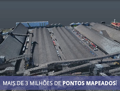
Raise local topography and altimetry using simultaneous photos taken by drones, with the possibility of analyzing georeferenced data (eg, knowing the exact location in coordinates of any point, measuring distances, areas or volume). Have a high definition image of the surface where a project will be carried out, guaranteeing the three-dimensional coordinates for graphic works and creation of 3D and 4D models. This is the goal of the new tool that LPC Latina is using in its projects, “3D Modeling with Drones”.
According to Renato Gama, executive director of LPC Latina, with this technique, the client also validates and reviews the material through virtual reality. “The technology, coupled with the development of the project in BIM, makes the material more realistic and agile in case of changes, since the customer itself can make any modification at the time of the presentation of the project.”
It is worth mentioning that “3D Modeling with Drones” can be applied not only in major infrastructure works, but also in residential projects. “In the real estate segment, for example, we anticipate the expectations of future residents in knowing how their house can be planned and decorated,” says Renato.
Learn more about this technique by accessing the presentation video of a project, developed by LPC Latina, for a new mill at the Rumo Terminal in the Port of Santos.